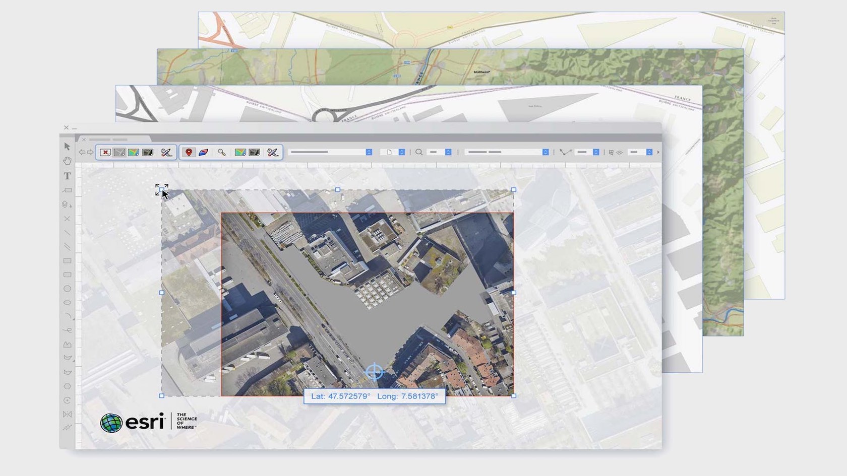
With the new Geographic Information System (GIS) toolset and integration with Esri’s ArcGIS online services, integrating GIS information with your BIM model just got a whole lot easier. After selecting an appropriate coordinate system in the Vectorworks file, you can accurately geolocate your project by simply entering an address. Instantly incorporate street map, satellite, or other imagery in your design through ArcGIS and WMS servers. And with a paid ArcGIS online service plan, you can access more maps and other imagery directly in Vectorworks.
Video
Landscapes
2 Minutes
Intermediate
LEARNING OBJECTIVES
- Learn about the new methods of Georeferencing in Vectorworks 2020.
- Explore the new Geolocate, GeoImage, and GIS Stake tools.
Requires Approval: No