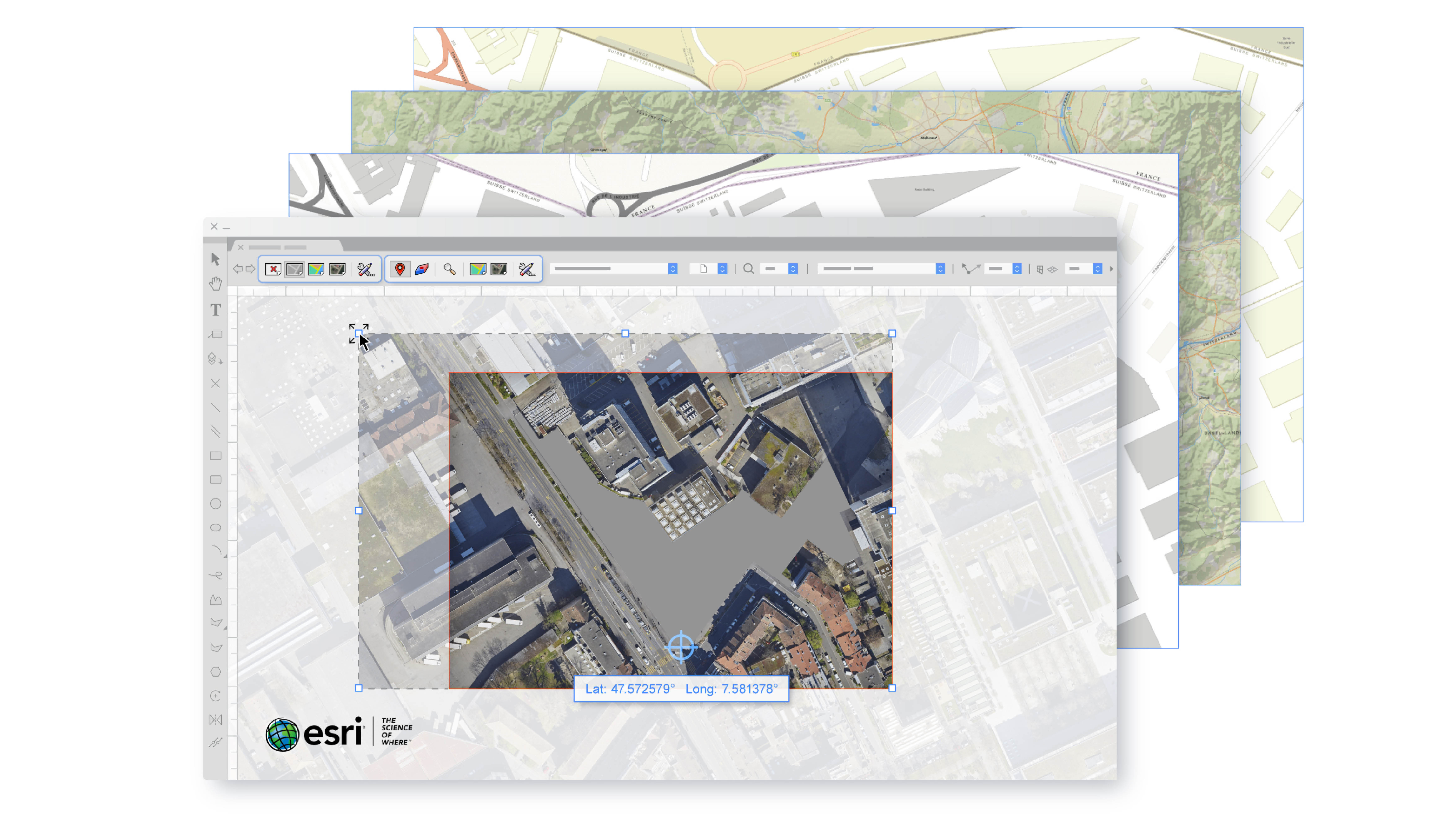
Join us as the Vectorworks training team explore the new GIS features in Vectorworks 2020 to combine valuable GIS resources from ESRI, with traditional CAD data. Georeferencing allows you to work with geographically-aware data, preserving this data to ensure that you can combine multiple georeferenced files accurately and export your finished project with preserved location information.
LEARNING OBJECTIVES
- Learn how to use the new Geolocate tool which enables you to set the location of the drawing origin within a given geographic coordinate system.
Discover the GeoImage tool with its live link to ESRI data.
Explore how to import traditional CAD data into a Geographic Coordinate system, to combine with GIS data.
Identify the different ways you can use GIS data for data visualisation, including the use of Shapefiles
- Manager: Mark Mullany
Requires Approval: No