
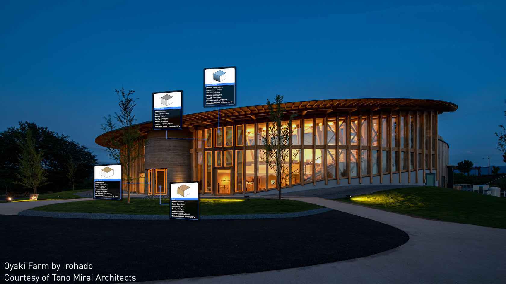

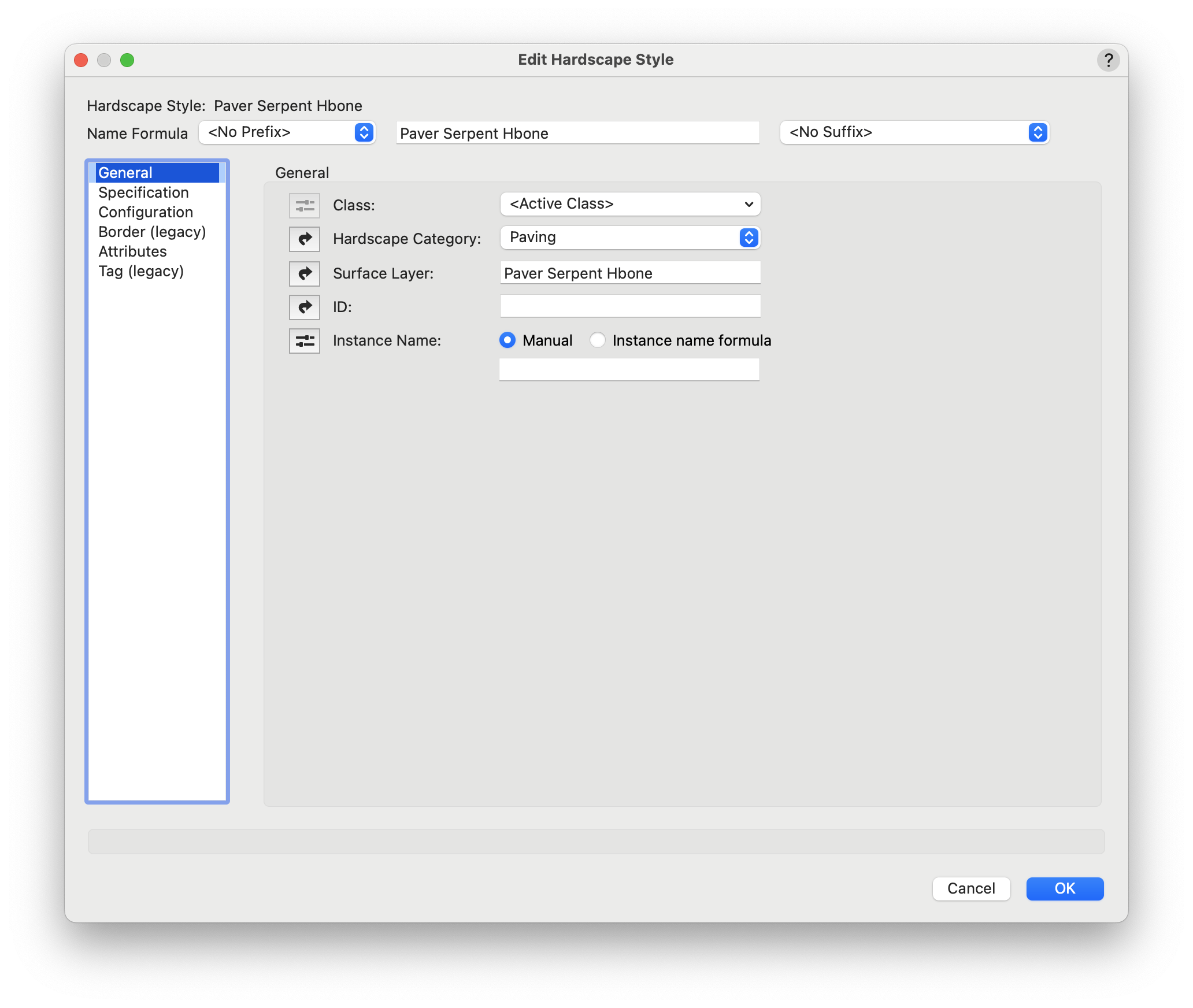
A hardscape is a 2D/3D hybrid object that consists of paved areas with joint patterns and optional borders. Multiple types and configurations of hardscape can be created, and they can be used either to modify the site model, conform to the site model or simply produce a texture overlay on the site model surface. Hardscapes can interact with the curb object, especially a curb acting as a border, by being aligned with a curb that acts as a site modifier, by grading the site model with the curb and then using the drape mode for the hardscape, or by having a curb associated with the hardscape.
For styled objects, only parameters set by instance can be edited from the Hardscape Preferences dialog box and Hardscape Object Settings dialog box.
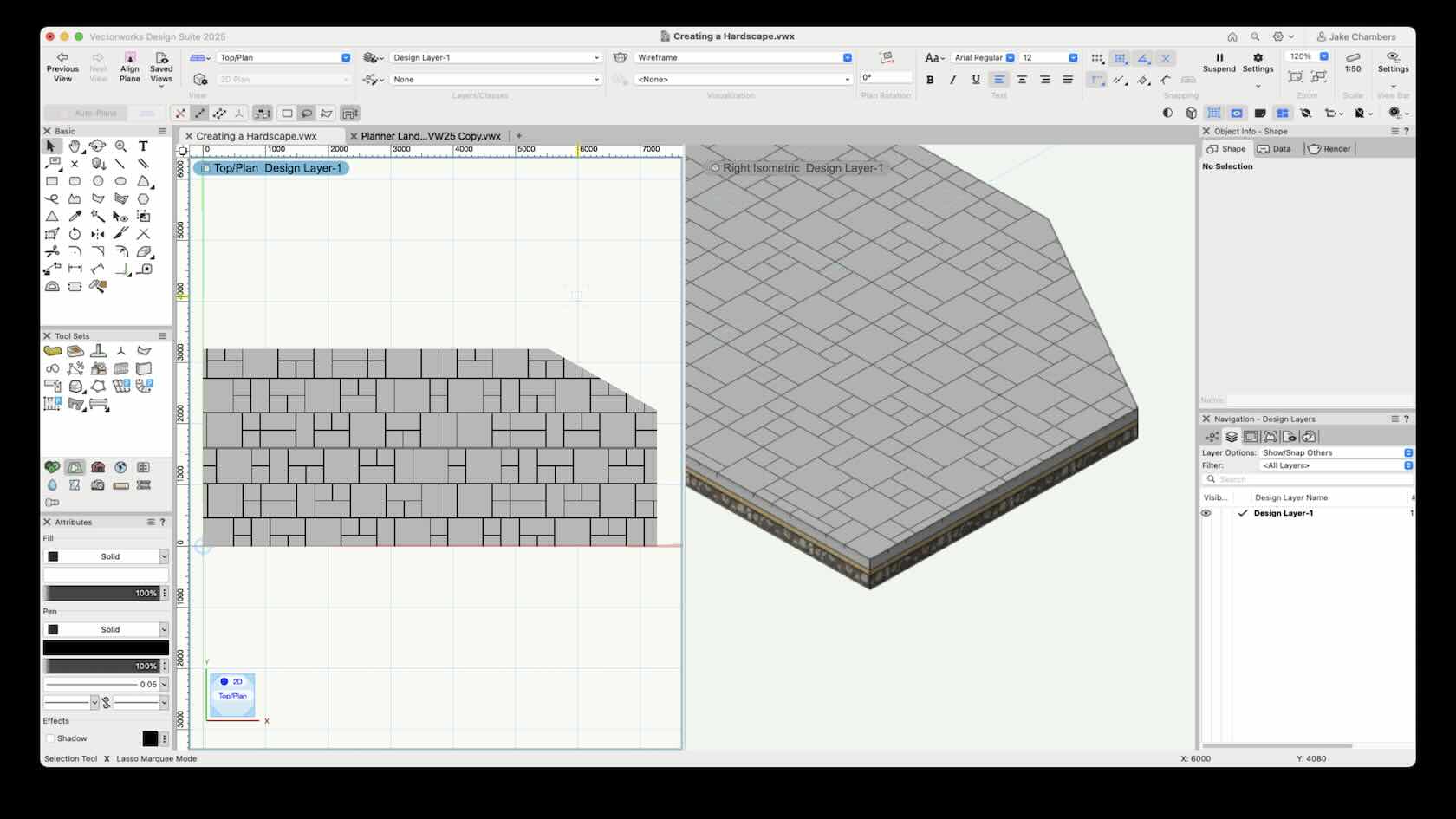
A hardscape is a 2D/3D hybrid object that consists of paved areas with joint patterns and optional borders. Multiple types and configurations of hardscape can be created, and they can be used either to modify the site model, conform to the site model or simply produce a texture overlay on the site model surface. Hardscapes can interact with the curb object, especially a curb acting as a border, by being aligned with a curb that acts as a site modifier, by grading the site model with the curb and then using the drape mode for the hardscape, or by having a curb associated with the hardscape.
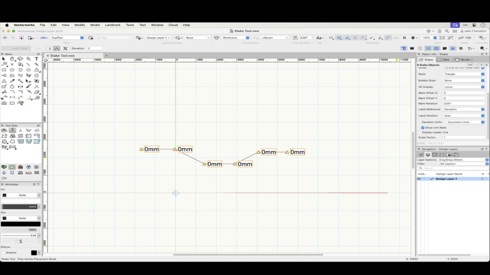
Stake objects represent a 3D point in space, with text that can display either elevation, coordinate points, or other information while in a Top/Plan View. The 3D representation of the Stake object can be either a 3D Loci or an Extrude.
The Stake object is a very useful and versatile tool, in this course we will look at the modes of the stake tool and their functionality along with the Stake Tools Preferences.
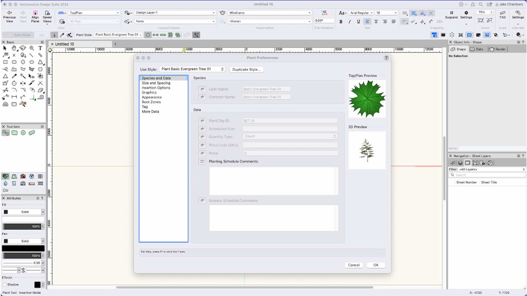
By using plug-in object styles, you can create plants with a combination of parameters that are determined by style or by instance. Style parameters have a fixed value established by the style; instance parameters can be set independently for each instance of the object in the drawing.
In this course we will look at Plant Styles and there settings along with using the Plant Tool Preferences which allows the setting of individual values of parameters that are set per instance prior to placement.
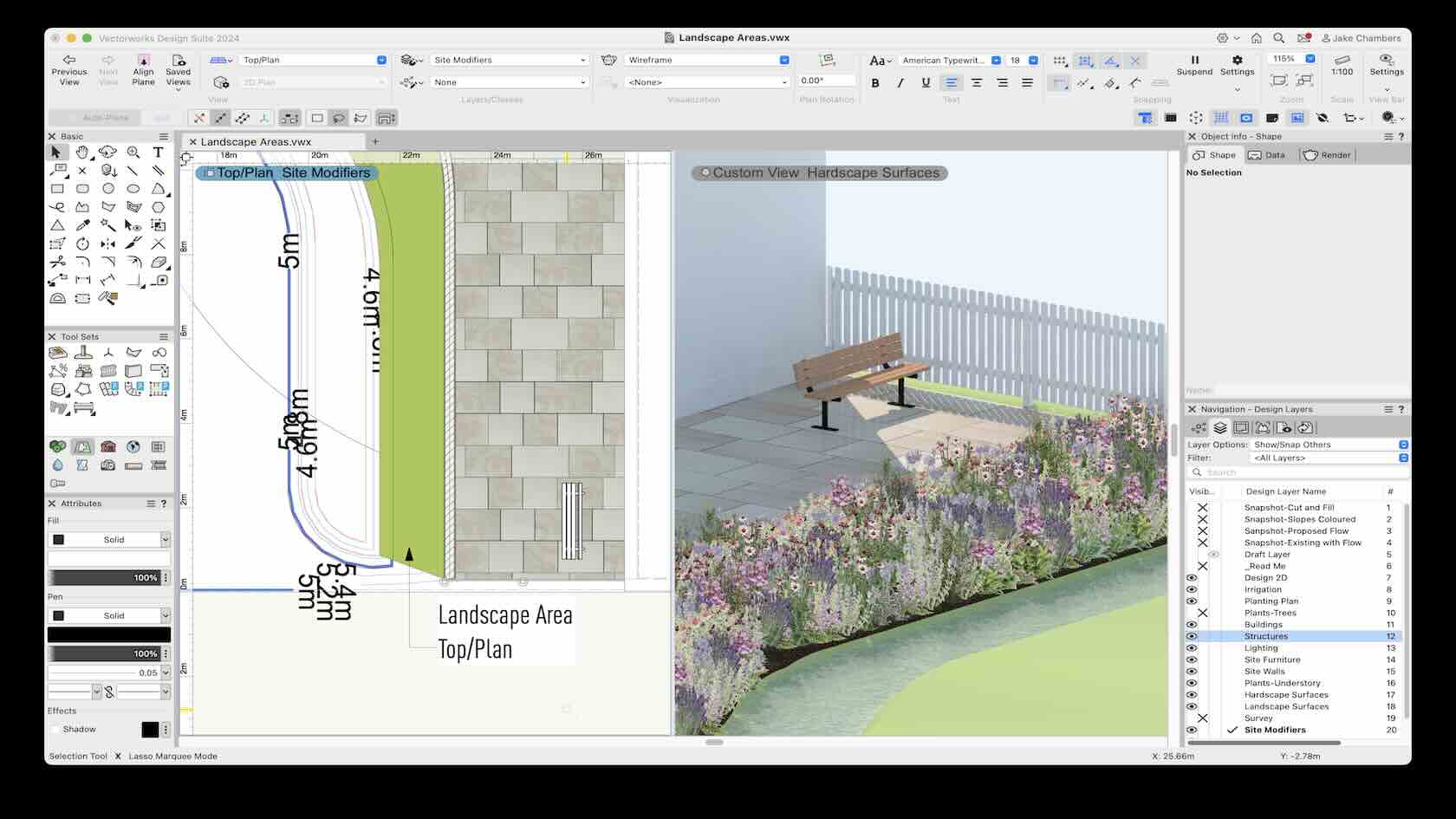
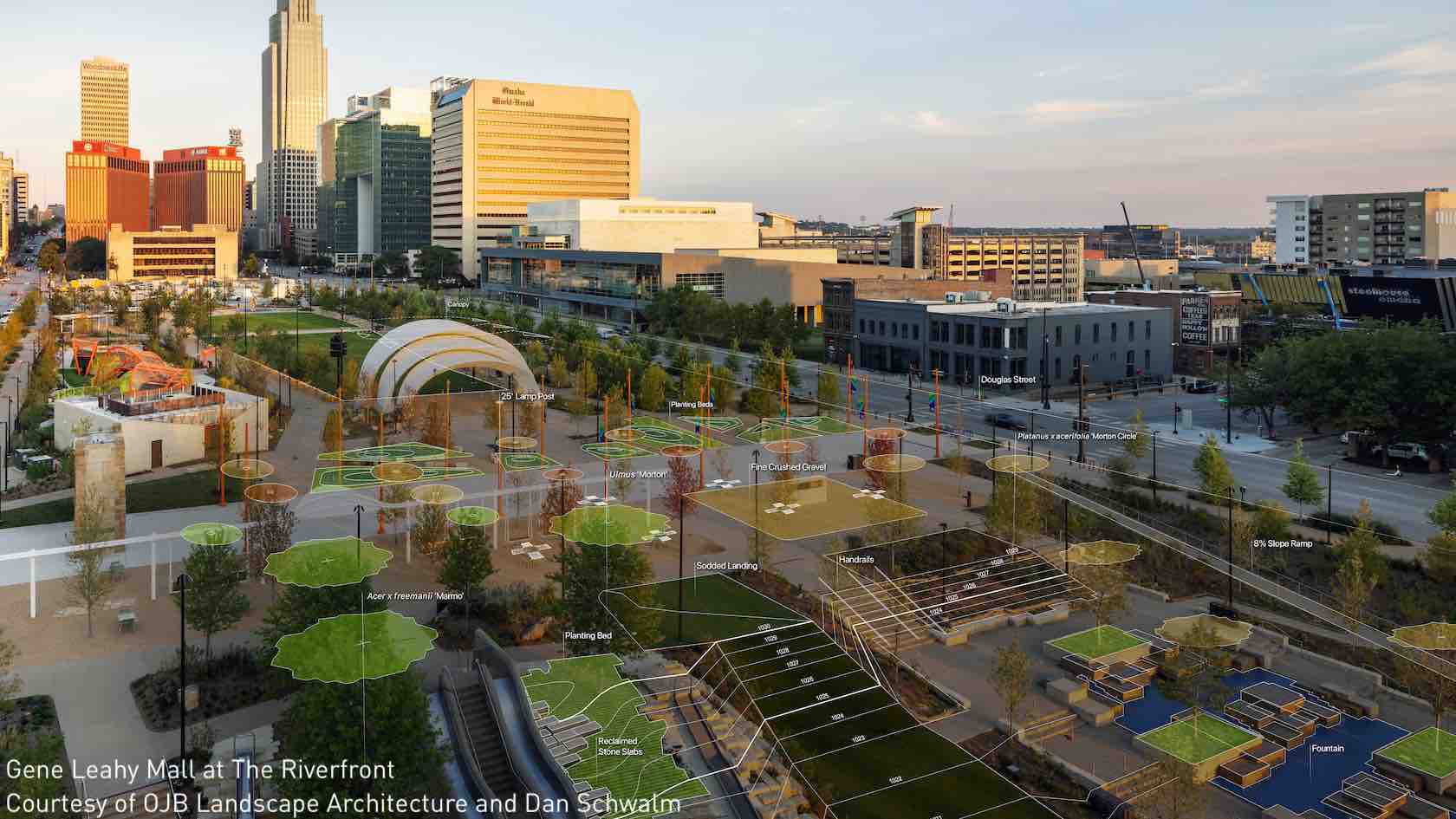
Landscape areas are defined regions of plant combinations. These can be useful for conceptual landscape planning and for specifying large planting or reforestation areas with plant symbols drawn in a representative way according to spacing or percentage values. Plant information from a landscape area is based on plant symbol data, and can be included in plant list worksheets. The landscape area can also consist of components which display in section views and can modify the site model.
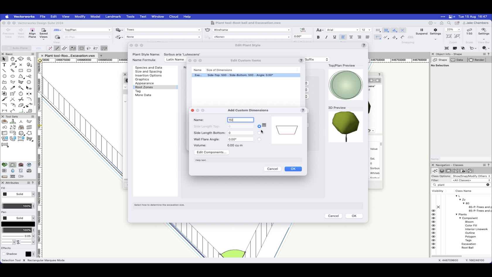
When the specification of your plants has been confirmed, you can edit the plant styles in your project and set up the root ball and excavation pit settings based on the sizes that will be installed onsite. These can be shown in both 2D and 3D, having root ball and excavation pit data helps aid designing and planning around your plants and to use in a BIM workflow for clash detection.

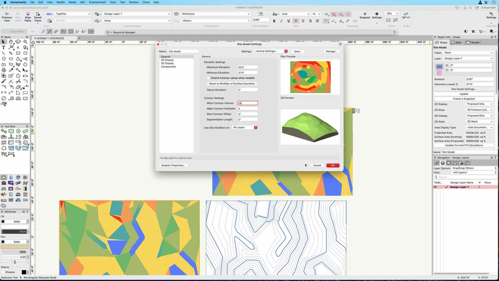
The Site Model Snapshot is a key component of Site Model analysis in Vectorworks. In this video, you will explore the Site Model Snapshot feature and it’s uses.